Saint-Esprit
Presentation
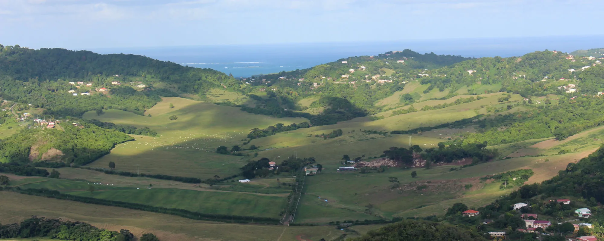
Le Saint-Esprit is a rural commune in the south-central region of Martinique. A true green lung of the island, its landscape is shaped by subsistence farming, vegetable crops, banana plantations, and sugarcane fields. The area is home to two protected natural zones—Bois La Charles and Morne Monésie—as well as Morne Baldara, which offers one of the island’s most stunning panoramic views. The town center nestles in a valley crossed by the Coulisses and Cacaos rivers, which flow into Génipa Bay via Rivière-Salée. Several streams also irrigate the commune, enriching its lush terrain.
History
Saint-Esprit is a commune nestled in the heart of southern Martinique. It lies southwest of Le François, east of Le Vauclin, north of Rivière-Pilote and Rivière-Salée, and east of Ducos.
The name “Saint-Esprit” comes from its original parish, which was dedicated to the Holy Spirit.
The area was once known as the “Bourg des Coulisses.” The name refers to the wooden chutes (coulisses) used to slide sugarcane down from the surrounding hills to the mills in the valleys. The Bourg des Coulisses was established around 1756 following the division of the former parish “Cul-de-Sac-à-Vache,” which included what are now the communes of Rivière-Salée, Trois-Ilets, Trou-au-Chat (now Ducos), and Saint-Esprit.
Originally just a small district, Bourg des Coulisses was elevated to the status of a commune and parish in 1758, under the name Saint-Esprit, and entrusted to the Capuchin monks.
A town gradually formed around the first church and the military square, located where the current cemetery stands. After the hurricane of 1788, the church, cemetery, and nearby homes were likely relocated eastward to a terrace protected from flooding by the Coulisses River.
Saint-Esprit officially became a commune in 1833.
Following the abolition of slavery, the area was frequently struck by epidemics of smallpox and especially yellow fever, due to recurring floods. The town layout was redesigned: the cemetery was moved back to its original location, and a hospital was built in 1855.
In 1870, Saint-Esprit became a canton. That same year, it was affected by the Southern Insurrection, which began in Rivière-Pilote. Between September 22 and 24, seven plantations were burned in the commune.
Economically, Saint-Esprit gained importance with the establishment of central sugar factories in Rivière-Salée and Petit-Bourg in 1871. Large plantations began delivering their cane to these factories or converted into distilleries. Smaller farms focused on growing cacao and subsistence crops.
The population from the hills surrounding the town provided much of the labor for these enterprises, while the town itself retained its commercial, administrative, and judicial roles.
After 1950, the population declined, likely due to the closure of the two factories in Rivière-Salée. However, growth resumed in the early 2020s.
Today, bananas, citrus fruits, and staple crops are the main agricultural products.
Economy
Saint-Esprit remains a rural commune, with subsistence farming occupying much of its agricultural land.
Its main tourist attraction is the Museum of Arts and Popular Traditions, which showcases the region’s cultural heritage.
Neighborhoods
The main districts are 7 Croisées, Baldara, Beauséjour, Bois Blanc, Bontemps la Cour, David, Dieuzede, Duchatel, Firmin, Fonds Coulisses, Fontenay, Four à Chaux, Grand Bassin Grosse Roche, Gogo, Grand Bassin, Grand Case, L’Avenir, La Capoul, La Carreau, La Ferme, La Nau, La Robert, La Suin, Laboissière, Lannuquette, Magdelonnette, Mathilde, Morne Babet, Morne Degras, Morne Lavaleur, Morne Vent, Moulin à Vent, Nicolas, Palmené, Peters Maillet, Petit Paradis, Placide, Providence, Régale, Régale Beauplan, Régale Fond la Pierre, Régale Modère, Rivière Moquette, Roussane, Saint Ange, Solitude, Suffin, Terres Gueydon, Thibault, Valatte, Vieille Citerne, and Vieilles Terres.
More information
 Saint-EspritMayor:Fred-Michel TiraultZip code:97270Number of inhabitants:10,522 inhab. (2022)Surface area:23,46 km² (9.06 m²)