

Anse du Carbet
The beach of Anse du Carbet or Plage du Coin is known for being the one on which Christopher Columbus landed on June 15, 1502. It is also the place that marks the beginning of colonization…

Anse Turin
Anse Turin beach is one of the few black sand beaches in Martinique. Its sand bears witness to Martinique's volcanic past, which dates back nearly 24 million years. If you get there early, you'll be…
historic sites

Canal des esclaves
The Canal des Esclaves (slaves canal) also called Canal de Beauregard is a place to hike on the heights of Carbet to the Fonds-Mascret neighborhood of Fonds-Saint-Denis. Built…
Jardin botanique
The botanical garden of Carbet "Habitation Latouche" is one of the oldest habitation of Martinique. Founded in 1643, it extended at this period over an area of 15 hectares. For…
Jardin des papillons
200 meters after the tunnel of Carbet towards Saint-Pierre, the Jardin des Papillons (Garden of butterflies) is a haven of greenery which mixed flora, fauna and music.…

Martinique Zoo
Located near the beach Anse Turin in the Habitation Latouche, founded in 1643, that is already home to…
museums

Gallery of history and Sea
At the History and Sea Gallery (Galerie d’Histoire et de la Mer), discover the entire history of Native American, Arawak, and Caribbean settlement, set against the…

Paul Gauguin Heritage Interpretation Center
Five months! This is the duration of stay of the painter Paul Gauguin (1848-1903) in Martinique, the island he had already visited…
distilleries
Habitation Neisson
Unlike other distilleries and rum producers in Martinique, which have more than a century of history, the Neisson distillery was founded in the 20th century. In 1932, brothers…
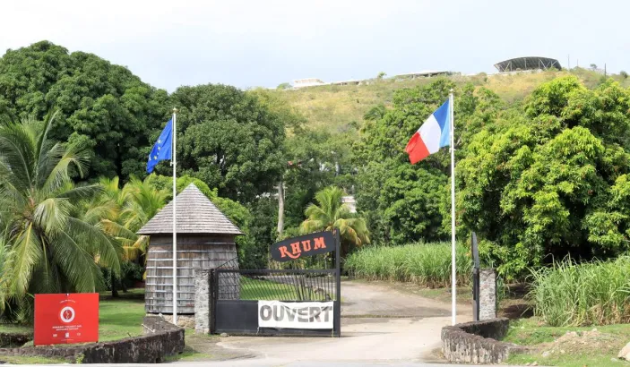
J.Bally
Known by all rum lovers, J. Bally distillery has been producing a quality product recognized throughout the world for several centuries.
In the 18th century, Baron de Lajus bought a small sugar…
More information
 Le CarbetMayor:Jean-Claude ÉcanvilZip code:97221Number of inhabitants:3,663 inhab. (2022)Surface area:36,00 km² (13.90 m²)
©AZMartinique.com 2026 all rights reserved